|
Navigation
zone
:
Move
the mouse on the costs and clic to discover pictures of the
navigation zone
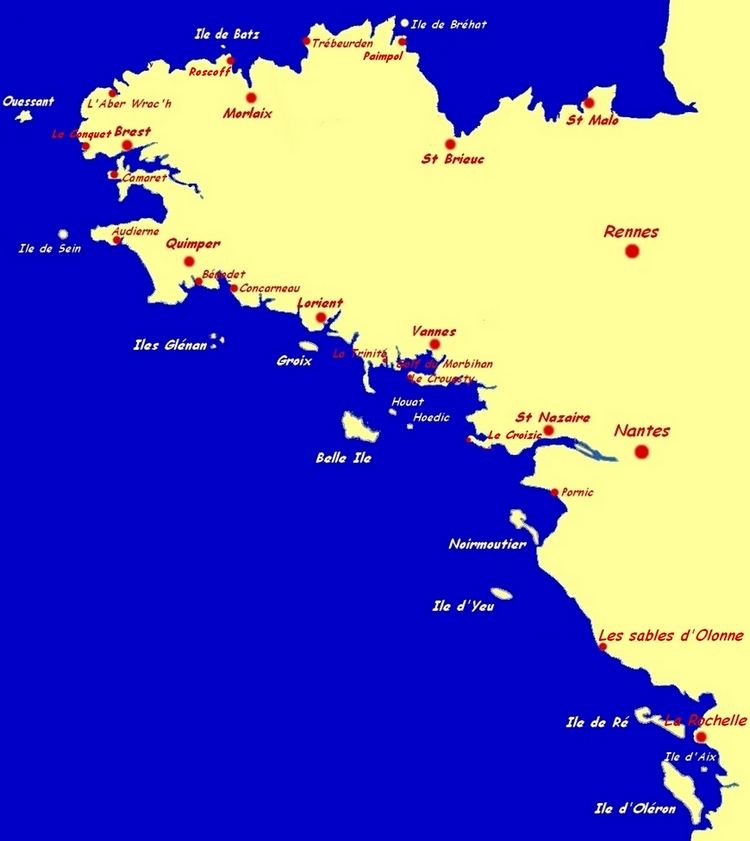
• North
of Brittany
/
Channel:
A very strong beauty with wild landscapes : magnificent beaches,
sculpted rocks, dunes of grass, turquoise water...
Navigation
in north Brittany requires a good planning
and much attention. Tidal stream is often strong. Every 6 hours,
the sea changes is direction. We just need to take in account
this phenomenon and we will make the current a friend
and not an enemy.
Iroise
Sea (west from Brittany): the Rade of Brest, which offers a
beautiful and sheltered bay , Camaret and its bay, the numerous
islands, (Ouessant, Molène, Sein…), Morgat and its
Bay, Douarnenez... is a navigation
zone offering any conditions of sea and stream.
North
Brittany
and the Mer d'Iroise are our privileged navigation zones when the
weather conditions are favorable.
South
Brittany
offers
an exceptionally rich navigation
zone, with many ports and Islands (Les Glénan, Belle
Île, Groix, Hoedic, Houat) and a softer climate than on the
north
coast of North Brittany.
This zone
is ideal at spring and in September. North
of Brittany :
A very strong beauty with wild landscapes : magnificient
beaches, sculpted rocks, dunes of grass, turquoise water...
Pertuis
Charantais
"Pertuis
Charentais" gathers the Islands " Rez, Aix and Oléron".
The sun is in this region very generous. The islands
are very nice and interesting to visit and offer excellent
navigation and mooring conditions. We will navigate in this part
when the conditions are not favourable further in the west.
|